The most recent Covid-19 statistics available for East Suffolk to April 17th 2024 are here - eastsuffolkcovid19.uk
(Last updated on: 25th April 2024 at 8:20pm)
-----◄►-----
- - - LINK TO GULL WING BRIDGE LIVE STREAM - - -
-----◄►-----
Click HERE to go to the latest uploads in the forum's gallery of bridge construction images

Britain from the Air.

This forum contains some of the topics from 2010 to 2015 which are now 'Read Only' so cannot be posted in but still remain accessible to all members. Where appropriate, new topics of the same name have been created in the main forum.
Locked
User avatar
boatbuilder
Site Administrator
Site Administrator
Posts: 57005
Joined: Sat Aug 28, 2010 4:36 pm
Male/Female: Male
Location: Carlton Colville - Lowestoft
Contact:

Britain from the Air.

Post by boatbuilder » Mon Sep 05, 2016 2:57 pm

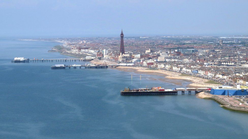
I read this first article yesterday, and saw the second one today. As they are both interesting and pretty much 'linked', I thought I would post them both here. One is images the other a short video:

In pictures: Britain from the air

Image Image Image
Images from Ordnance Survey (Click to enlarge)


How Britain's rural routes are mapped
See my Suffolk Pictures at https://suffolk-world.com

Image
S t r e t c h e d - O y s t e r

You forget what you want to remember and remember what you would prefer to forget

Locked